Perimeter Intelligence Suite: AI-Driven Border Surveillance
Enabled automated threat detection across distributed sensor networks with real-time classification. Three integrated modules — terrain monitoring, aerial GIS mapping, and time-pattern analysis — unified as a full perimeter intelligence platform.
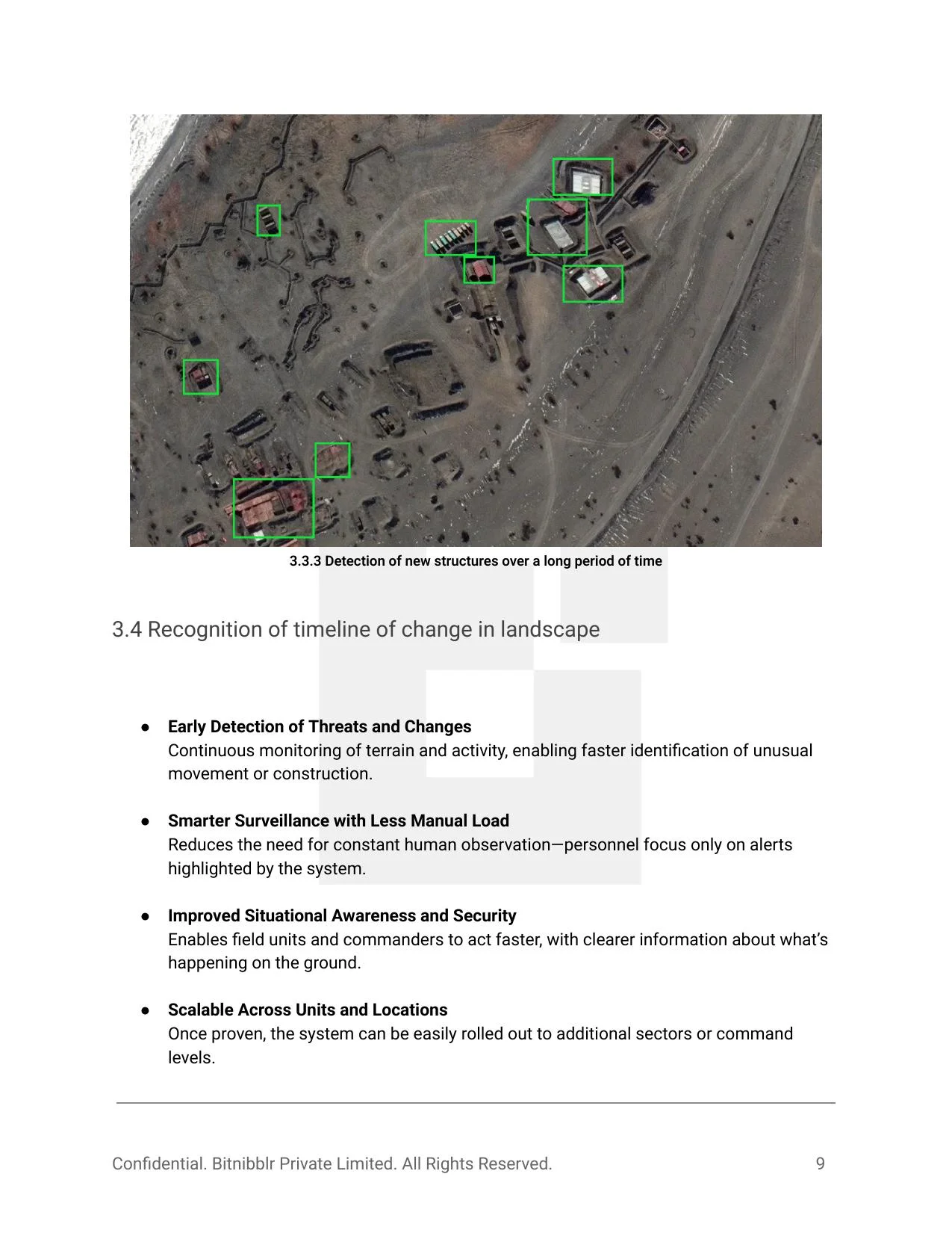
ATMoS aerial detection — multiple new structures identified across the monitored zone
Existing perimeter security systems at critical installations rely on static sensor networks and manual operator monitoring — creating detection latency and high false-positive rates that degrade operator trust and increase response times. Continuous surveillance of vast border terrain with scheduled drone flights and physical reconnaissance is costly, non-continuous, and reactive. What was needed: an always-on, layered intelligence system that flags threats automatically and escalates only what matters.
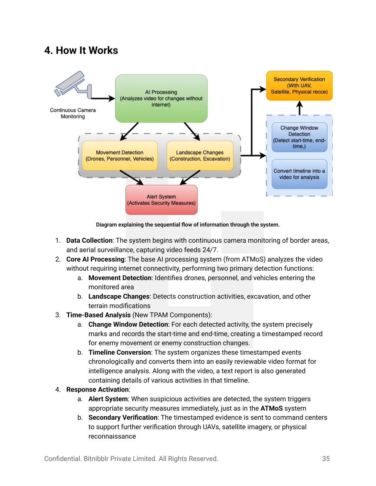
Designed and built a three-module AI surveillance platform, each module independently operable but architecturally integrated. ATMoS handles real-time detection across camera and UAV feeds. AIM-GIS converts aerial imagery into operational GIS maps automatically. T-PAM adds temporal intelligence — building a timestamped record of activity that reveals patterns invisible in real-time monitoring. All processing runs locally on high-end hardware with zero internet dependency, architected for operation from Battalion to Command level.
ATMoS
AI Terrain Monitoring System
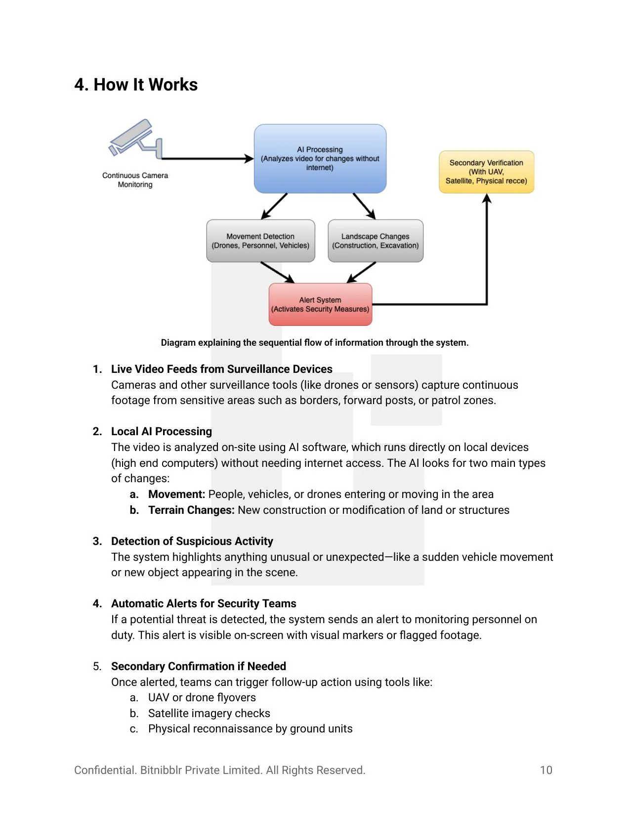
Continuously monitors camera and UAV feeds for movement of vehicles, personnel, and drones — and for slower structural changes like new construction or terrain modification. Runs locally on high-end hardware with no internet dependency.

Key Capabilities
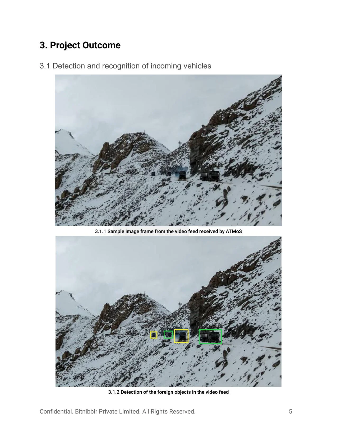
- Real-time detection of vehicles, personnel, and drones entering monitored zones
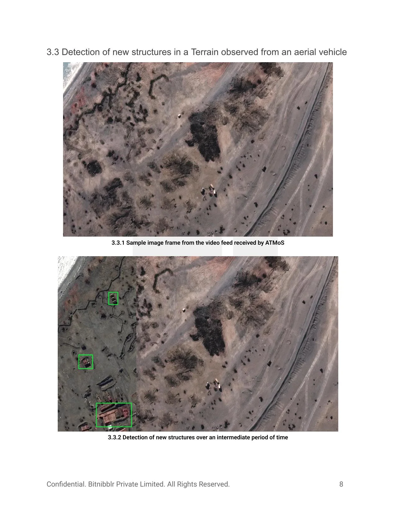
- Long-term terrain change detection — new structures, excavation, construction
- Aerial feed analysis for top-down structural surveillance
- Automatic visual alerts to monitoring personnel — no continuous manual watch required
- Triggers secondary verification via UAV, satellite, or ground reconnaissance
- Operates under varying weather, lighting, and terrain conditions
AIM-GIS
AI-based Mapping & Georeferencing Integration System
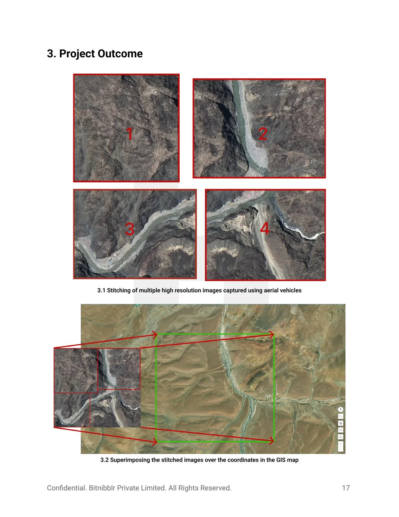
Automatically stitches multiple aerial images — captured from different angles and altitudes — into a single unified view and places it accurately on a GIS map using GPS metadata. Reduces hours of manual expert processing to minutes.
Key Capabilities
- Automatic stitching of multiple drone images from varying angles and altitudes
- GPS-based georeferencing — accurate alignment with real-world GIS coordinates
- Supports planning, surveillance, and operational documentation
- Works across rural, urban, and remote terrain types
- Seamless integration with standard GIS platforms used at field and command level
- Reduces dependency on expert technical teams for map generation
T-PAM
Time Pattern Analysis Module
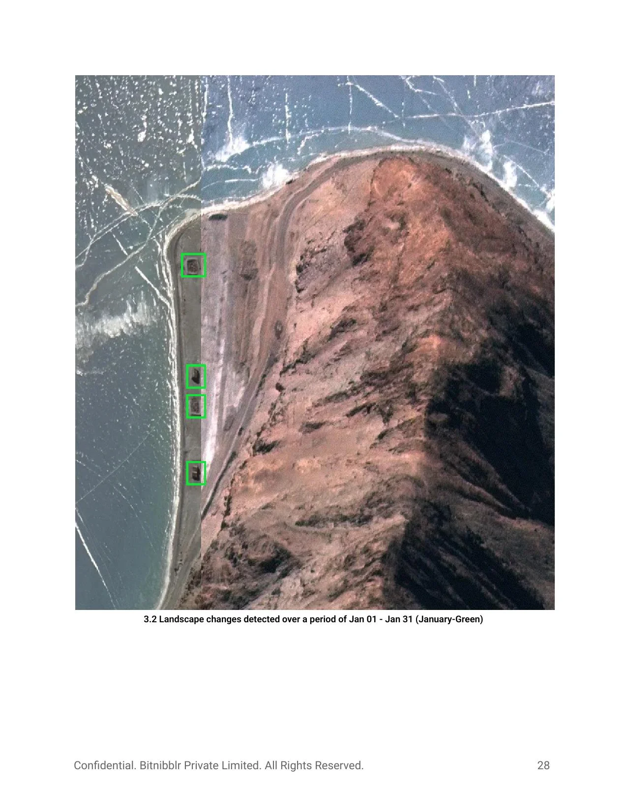
Built on top of ATMoS, T-PAM adds temporal intelligence — precisely timestamping detected activities and building a chronological record of construction, movement, and terrain change over weeks and months. Eliminates manual review of hundreds of hours of footage.

Key Capabilities
- Precise start-time and end-time markers for each detected movement or construction event
- Chronological visual timeline of landscape evolution — month-by-month construction tracking
- Highlights newly changed areas in distinct colors per time period (green → yellow → blue → red)
- Generates timestamped video clips and text reports of detected events
- Enables pattern recognition — reveals recurring schedules in adversarial activity
- Integrates with ATMoS alert system for immediate + historical awareness
- Multi-sensor fusion under varying lighting, weather, and terrain conditions — mountain, desert, and river valley environments each introduce different false-positive profiles.
- Real-time inference at edge with no internet — models must run entirely on local high-end hardware at the node, without cloud dependency.
- Long-term terrain change detection requires persistent baseline comparison across weeks of video — managing storage, drift, and seasonal variation.
- GPS-based aerial image georeferencing across images from varying altitudes, angles, and camera orientations without a fixed reference frame.
- T-PAM temporal analysis must maintain consistent event records across multi-month deployments without unbounded storage growth.
- System designed for hierarchical deployment: Battalion → Brigade → Division → Corps, each level aggregating and prioritizing data from below.